
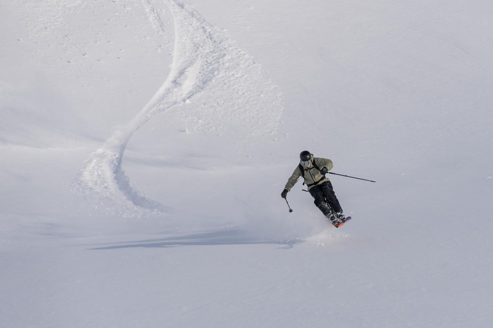
Freeriding in LAAX
The yellow marked runs in LAAX allow experienced winter sports enthusiasts to explore the terrain away from the groomed slopes. These freely accessible, ungroomed areas offer a pristine nature experience and are intended for riding in open terrain.
Freeride routes

No. 70 – Viwalti
Start: Bergstation Cassons
Finish: Piste 10
Length: 3 km
Elevation difference: 800 m
Route No. 70 leads through the wide, ungroomed Cassons slope with even slopes and a short traverse above Alp Cassons. Afterwards, the terrain opens up with natural halfpipes. At the bottom, it goes through lightly vegetated terrain to the former Naraus traverse and further to slope 10 back to Flims. Around 3 km and 1,500 meters of altitude – ideal for freeriders looking for a real mountain experience.

No. 71 – Vivorak
Start: Bergstation Cassons
Finish: Segnes
Length: 2 km
Elevation difference: 400 m
Route 71 runs close to the ridge and offers an impressive panorama over Dolf, the Segnes Atlas and the upper Segnesboden. After a passage at Tschengel dil Gori, the path leads behind the protective fence over a short steep section – the key point – into the Casson slope. Through a boulder field and past Brunstei, you reach the lower Segnesboden and cross the Flem. A short counter-ascent finally leads to the Segneshütte. After about 2 km and 400 meters of elevation, your legs will be well challenged.

No. 73 – Altes Trasse
Start: Bergstation SB6 Mutta Rodunda
Finish: Piste 16
Length: 1.3 km
Elevation difference: 320 m
Route 73 starts at the mountain station Mutta Rodunda and leads southwards under the cable car through moderately steep, undulating terrain. At the rock edge, the 'Menschenfresser', it runs to the right keeping a distance from the rock. Afterwards, it goes through the once notorious steep slope. Then the route crosses the slope and the winter hiking trail, follows the railway line over an undulating area with some possible jumps and finally ends at the slope.

No. 76 – Uno
Start: Mountain station GB10 La Siala
Finish: Old valley station of the SB3 La Siala at slope 23.
Length: 2.2 km
Elevation difference: 500 m
From the mountain station La Siala, the route leads southwards over two terrain steps through high alpine terrain with wide views. At a terrain incision, you reach the broad southeast slope and make your first turns. After a distinctly descending section, you pass the valley station of the first ski lift generation, where the last traces of the karst area are still noticeable. At the valley station of the old La-Siala-Bahn, you reach the ski slope again.

No. 77 – Pign
Start: Entrance Sattelpiste on the Vorab Glacier
Finish: Slope 31, Vorab-Fuorcla just before the intersection traverse No. 38
Length: 1.3 km
Elevation difference: 500 m
The route starts at the saddle of the legendary entrance to Lavadinas. An approximately 80-meter ascent over the often wind-blown ridge leads to a 2,900 m high summit with an impressive panoramic view. To the southeast, a long, steep slope opens up, gently flattening out below – ideal for wide carving turns. At high speed, you reach the small canyon at the foot of the Pign and continue into the wide karst area before the route merges onto piste 31.

No. 80 – Fläschahals
Start: Mountain station SB6 Lavadinas
Finish: Slope 31, Vorab-Fuorcla shortly before the intersection with Slope 36
Length: 1.2 km
Elevation difference: 300 m
The route starts at the mountain station of the Lavadinas chairlift and leads over a spacious, moderately steep area to traverse no. 38 towards Sogn Martin. Afterwards, it continues over a long ridge and under the highest power line in Europe. Two terraces with distinctive steep slopes follow before the route leads back to the slope.

No. 81 – Oven
Start: Bergstation GB10 La Siala
Finish: Piste 10 shortly before the turnoff towards Grauberg
Length: 2.3 km
Elevation difference: 500 m
From the mountain station La Siala, you head briefly east and then traverse to the right onto a windblown ridge. There, a huge bowl opens up from Laaxerstöckli to Ofen – perfect freeride terrain. The route first leads through open, evenly sloped terrain before the bowl narrows and a rocky outcrop divides it into two areas. To the left of this, a noticeably steeper section begins. Finally, you pick up a bit of speed, enjoy the view of Tschingelhörner, Segnes and Atlas, and return to piste 10 via a wide right turn.

No. 82 – Japaner
Start: Crest La Siala, mountain station SB6 Alp Dado
Finish: Slope 40 Masegn-Plaun, before steep slope new bridge
Length: 1.3 km
Elevation difference: 500 m
The route starts at 2,324 m at the Alp Dado mountain station and leads north through boulder fields and between large erratic blocks. After two wide terraces with occasional snow cornices, the terrain becomes steeper towards the end. At the tree line, you reach the new bridge and meet piste 40 there.

No. 83 – Muladera
Start: Crap Sogn Gion
Finish: Piste 66, Kamelbuggel
Length: 2 km
Elevation difference: 320 m
From the 2,216 m high Crap Sogn Gion, head eastwards, under the 6-seater chairlift and along the narrow Geissenpfad to the north. After that, the rolling alpine pasture opens up. After crossing the summer trail, the terrain becomes steeper before you turn right into the forest at the tree line. On the forest road, you return to the slope 66 at Alp Curtgani.

No. 84 – Rene's long way
Start: Crap Masegn
Finish: Schlittelbahn Curnius-Falera, in the middle at the left turn.
Length: 6.1 km
Elevation difference: 1010 m
From the 2,465 m high Crap Masegn, the route leads southwards to the traverse to Crest da Tiarms, initially along the descent to Ladir. At the end of the traverse, it branches off to the left into open terrain, where flat and steeper sections alternate up to the upper alpine hut of Falera. Afterwards, you briefly follow the summer road and turn sharply left at the edge of the forest onto a narrow forest path to the lower alpine hut. Then you cross open meadows back to the summer road and down the toboggan run to Falera – with appropriate consideration.

No. 85 – Naturpipe
Start: Crap Masegn
Finish: valley station chairlift Treis Palas
Length: 2.3 km
Elevation difference: 110 m
The route starts at the 2,465 m high Crap Masegn and leads eastwards parallel to the Treis Palas chairlift over a wide, flat area to the distinctive steel support of the aerial cableway. After that, the terrain drops and leads quickly through a dry gully that acts like a natural superpipe. Shortly after, you reach the valley station of the chairlift back towards Masegn.

No. 86 – Baywatch
Start: Fuorcla Sura, mountain station chairlift Lavadinas-Fuorcla Sura
Finish: Slope 65 (Sattel), near Alphütte Fops
Length: 1.2 km
Altitude difference: 400 m
The route starts at the Lavadinas mountain station and soon leaves the slope – with a wide view over the Surselva. After two ridges, you reach the Fuorcla da Sagogn, a natural pass along the long ridge. From here there is no turning back, so be sure to check the time and the operating status of the lift. Afterwards, a straight, evenly sloped hillside leads to the Fops alpine hut – ideal for long, enjoyable turns.
Safety measures
Safety when freeriding
Safety is the top priority when freeriding!
The search for buried persons is intense and pushes everyone involved to their limits. Therefore, the top rule when freeriding: Prepare thoroughly and bring the right equipment. Here we show you some tips on how you can avoid putting yourself and others in LAAX in danger. Important note: These tips do not replace a professional course.
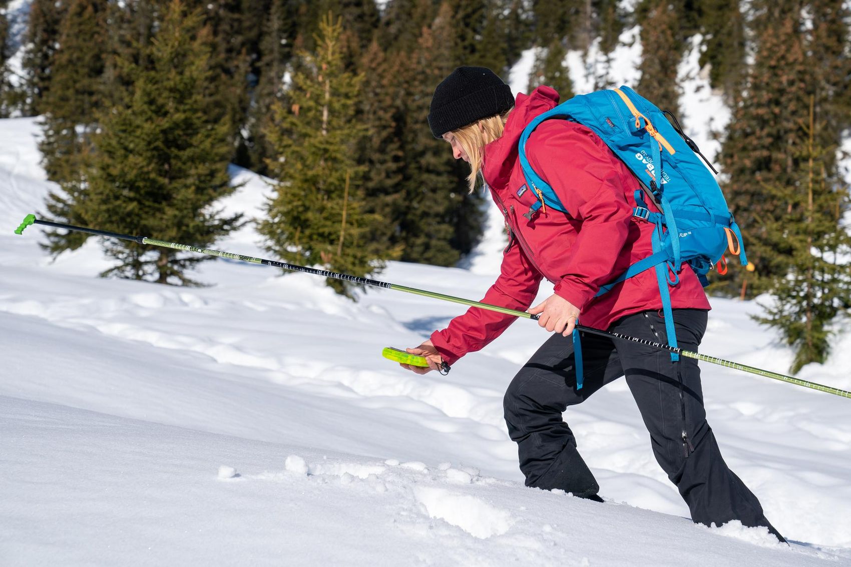
Avalanche Training Center (ACT)
At the mid-station in Plaun you will find the Avalanche Training Center ATC. The permanent facility simulates an avalanche burial and gives you the opportunity to regularly test your equipment and prepare yourself for an emergency situation before it happens. With up to 16 transmitters buried in the search area (100 x 100 meters), an avalanche rescue is simulated after successful pinpointing. Even the search times for each individual location can be recorded. You can reach the training area via the slopes to Plaun or from the Flims valley station with the Arena Express.

Equipment
The LAAX Rental offers everything you need so you can rely on your equipment during your adventures. Rent your equipment directly at the valley station.
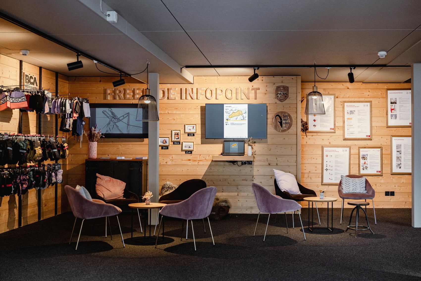
Freeride Base LAAX
The Freeride Base in Nagens is the place where you can talk with the patrollers about the current snow and avalanche situation. Over a good coffee, you can share powder experiences and get tips for off-piste runs in deep snow. This promotes freeriders' understanding of the daily work of the patrollers, for example, when parts of the area are closed in the morning due to avalanche blasting, or during slope checks and when skiing off-piste.
Good to know
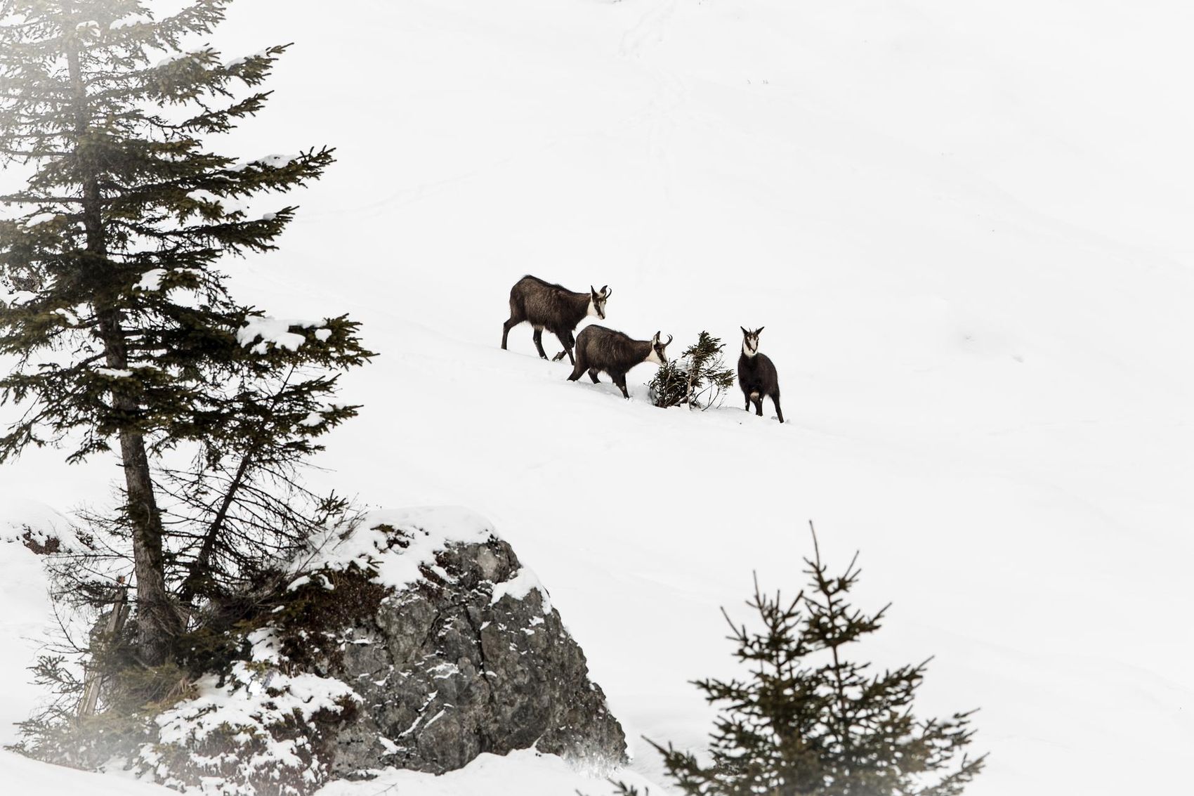
Wildlife protection zones
Although wild animals can get used to the presence of humans, they need the opportunity to retreat to quieter areas. This is especially important in winter, as they need peace in order to use as little energy as possible and thus survive the cold season. Please therefore respect the wildlife rest zones marked on the Pistenplan and on signs.